 Spring
  Summer
 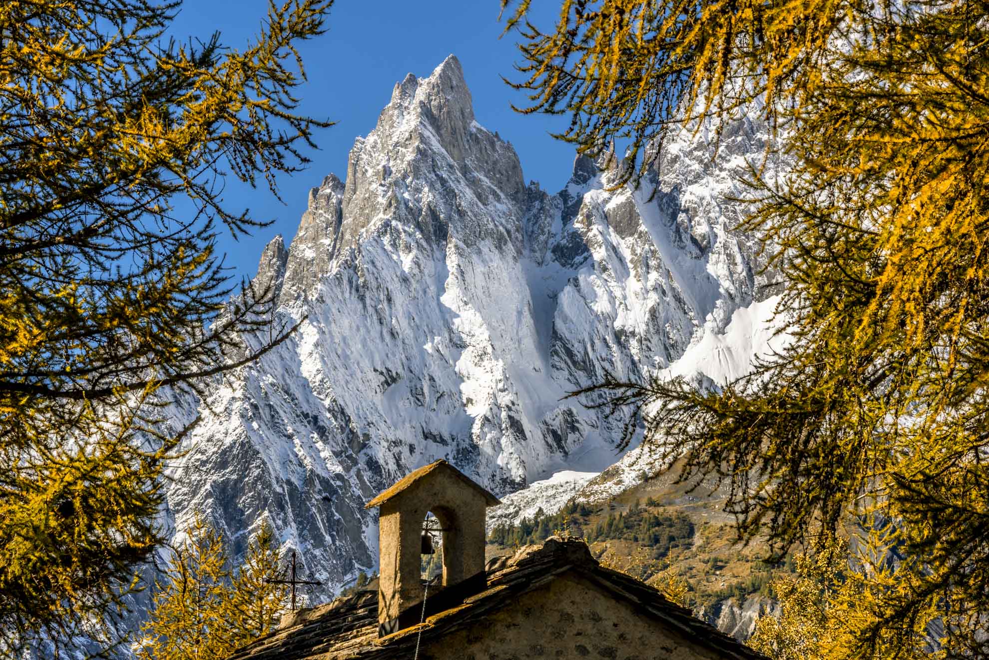 Autumn
  Winter
 Bertone and Bonatti
The route winds along the Mont de la Saxe where a path can be walked with a view of Mont Blanc.
The route is a racetrack for trail running competitions such as the Ultra Trail du Mont Blanc and the Tor des Géants.
The route offers panoramic views of the pastures occupied by herds of local cows, old larch, rhododendrons and blueberries.
Type
E - Trekking
Difficulty
Medium
Recommended period
From June to October
Departure
Courmayeur (1.224 Mt)
Altitude difference
874 mt
Length
10.720 mt
Duration
5h 00'
Signage
AV1 - TMB
Itinerary description
The itinerary begins in Piazza Abbé Henry, along the street of Strada del Villair.
You stay on the road that, uphill, leads out of Courmayeur to the hamlet of Villair Superiore (1,325 meters), continue up to a well-marked junction, and cross the bridge over the stream.
On the left, a path through the trees allows you to cut some hairpin bends. Turn right and take the path, signposted TMB, with signs for the Bertone refuge.
From the junction on the road, you reach the village of Le Pré, dominated by the refuge Bertone (1,989 mt). Just before arriving at the refuge, you can enjoy a wonderful view of Mont Blanc, the Aguille Noire du Peuterey, and 700 meters below, Courmayeur. Following the path to the right of the refuge, you reach a panoramic table (2,030 meters) where the path divides: on the left, it proceeds to the Val Ferret along the route of the Tour du Mont Blanc, on the right, it climbs towards the ridge of Mont de la Saxe.
Following the Val Ferret and the Bonatti refuge, the path creeps through thickets and meadows always offering priceless views: when you fork upstream of the ruins of Alpe Lechey (1938 mt) you continue on the main path and get behind the Alpe Léche (1.929 mt). After a few ascents descend into the middle of the pastures, past the
Vallone di Arminaz, you reach the refuge Bonatti (2.025 mt). and the beginning of the Comba di Malatrà.
Useful tips for hikers
– According to the regional law it is forbidden to set up tents and camp below 2500m.
– Help us protect the mountains! Remember to leave the paths as you found them: collect your waste, you can throw them and differentiate once you return to the valley.
– In the mountains, you need appropriate clothing: bring with you sunscreen, a windbreaker, and hiking shoes.
– Keep a trail map in your backpack in case you lose your phone line.
– Always consult the weather conditions before organizing your trip.
– There are no refreshment points or fountains along some of these routes. Remember to always bring the right amount of water with you.
– To ensure safety for the youngest hikers, it is advisable to walk along the paths on the side of the mountain.
– Given the presence on the trail of other hikers, but also marmots, squirrels, and other components of the local fauna, it is recommended to keep dogs on a leash.